Find your place.
7 settlements, 35 districts, and the places where everyday life happens.
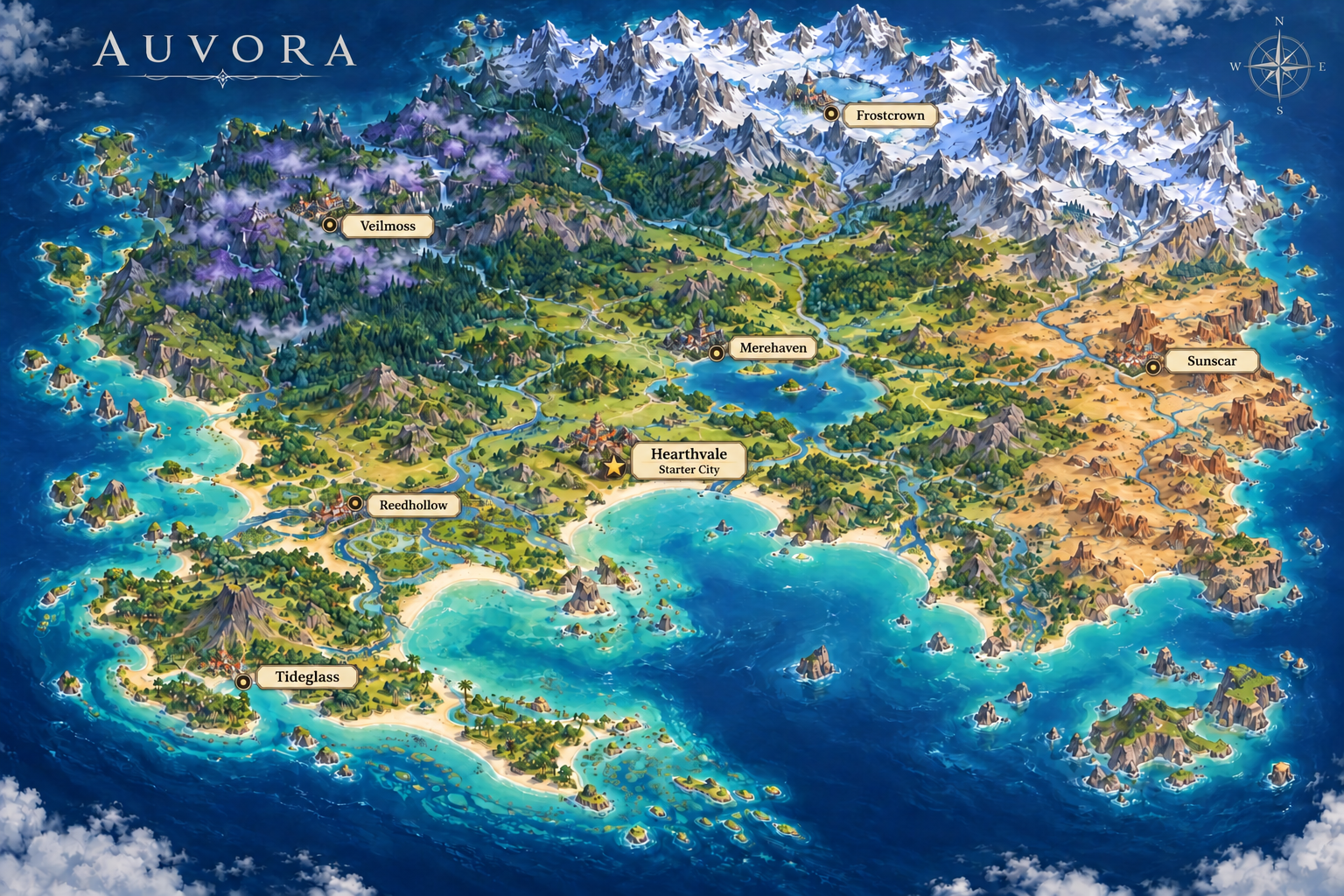
Your original map, preserved. Tap a city marker or choose a city below. The full map fits your screen. Use your browser’s zoom for a closer look, or choose a city from the list below. Marker rings follow the supplied map, not survey coordinates.
A map we can build from
The existing cities and landforms are the starting point. Each city now has an illustrated district map below. Its internal street arrangement is a proposed layout; remaining towns, named routes and travel times are still being developed.
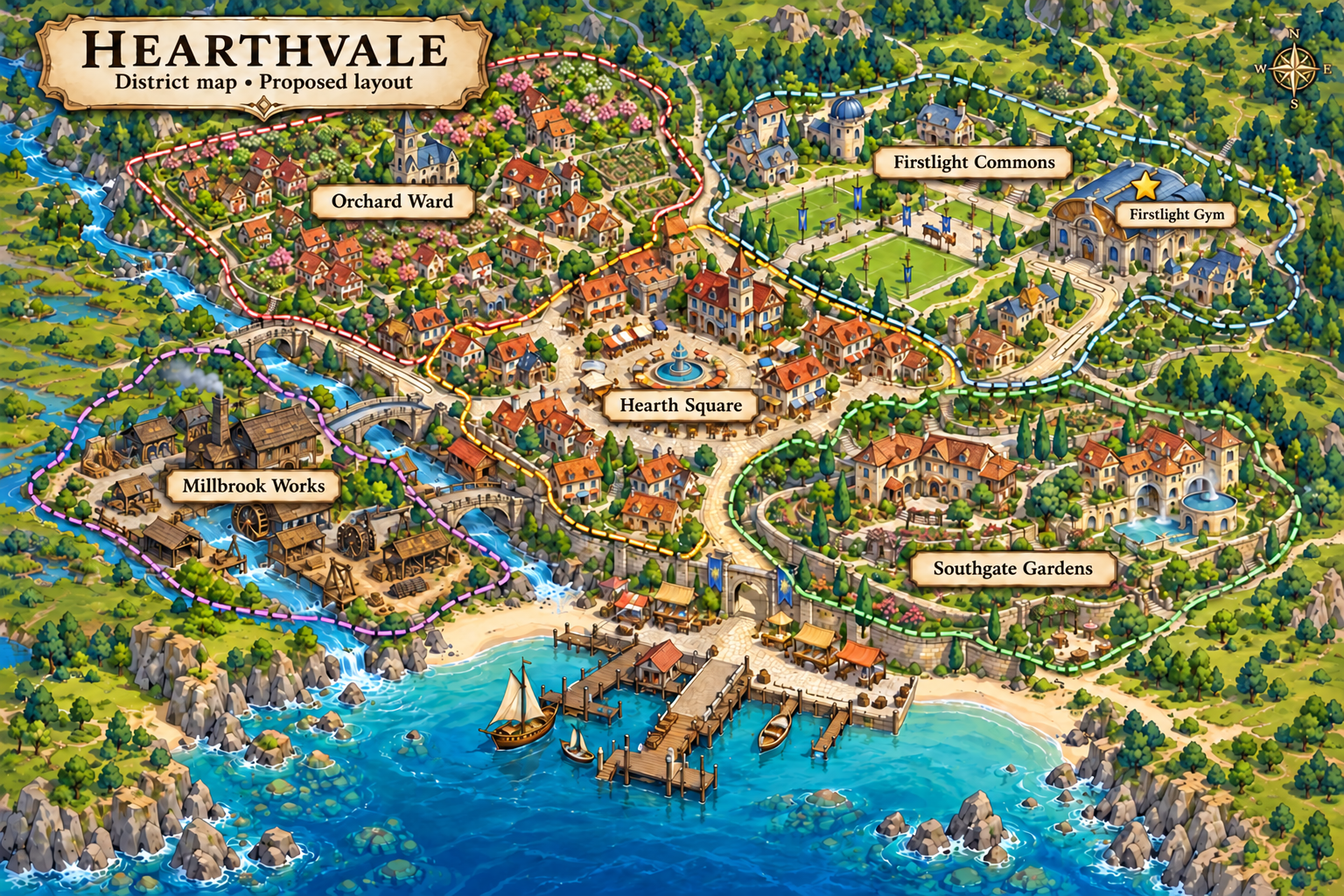
Hearthvale →
Starter city in the green valley above the sheltered southern bay, southwest of the central lake and east of the wetlands. Its five districts keep the beginning of a journey approachable while supporting a lived-in town.
Gym: Firstlight Gym
District: Firstlight Commons
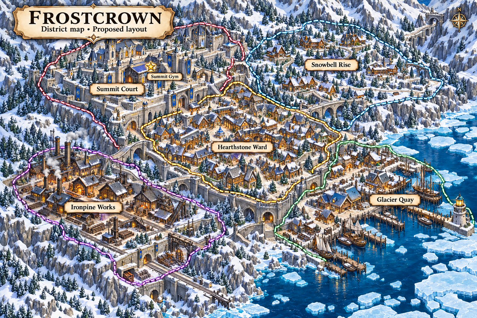
Frostcrown →
Alpine city in the northern snowy basin beside the high mountain lake. Sheltered streets and practical heating connect five districts built for cold-weather life.
Gym: Summit Gym
District: Summit Court
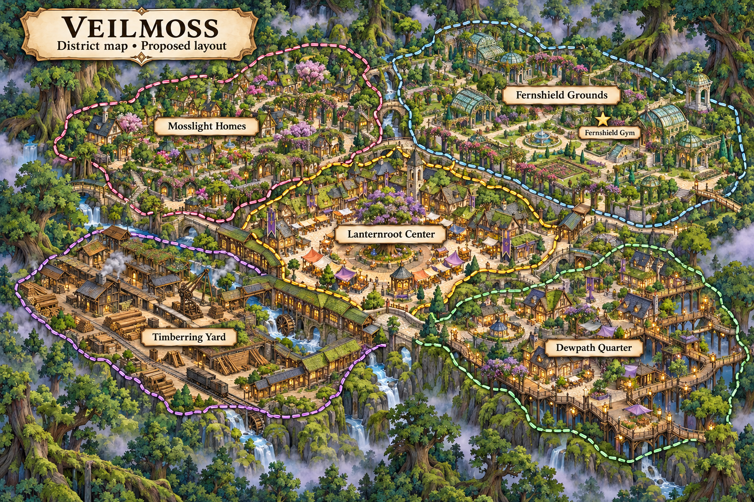
Veilmoss →
Forest city nested in the misty western woods. Five districts combine sturdy ground-level streets with carefully managed woodland paths, leaving the surrounding forest intact.
Gym: Fernshield Gym
District: Fernshield Grounds
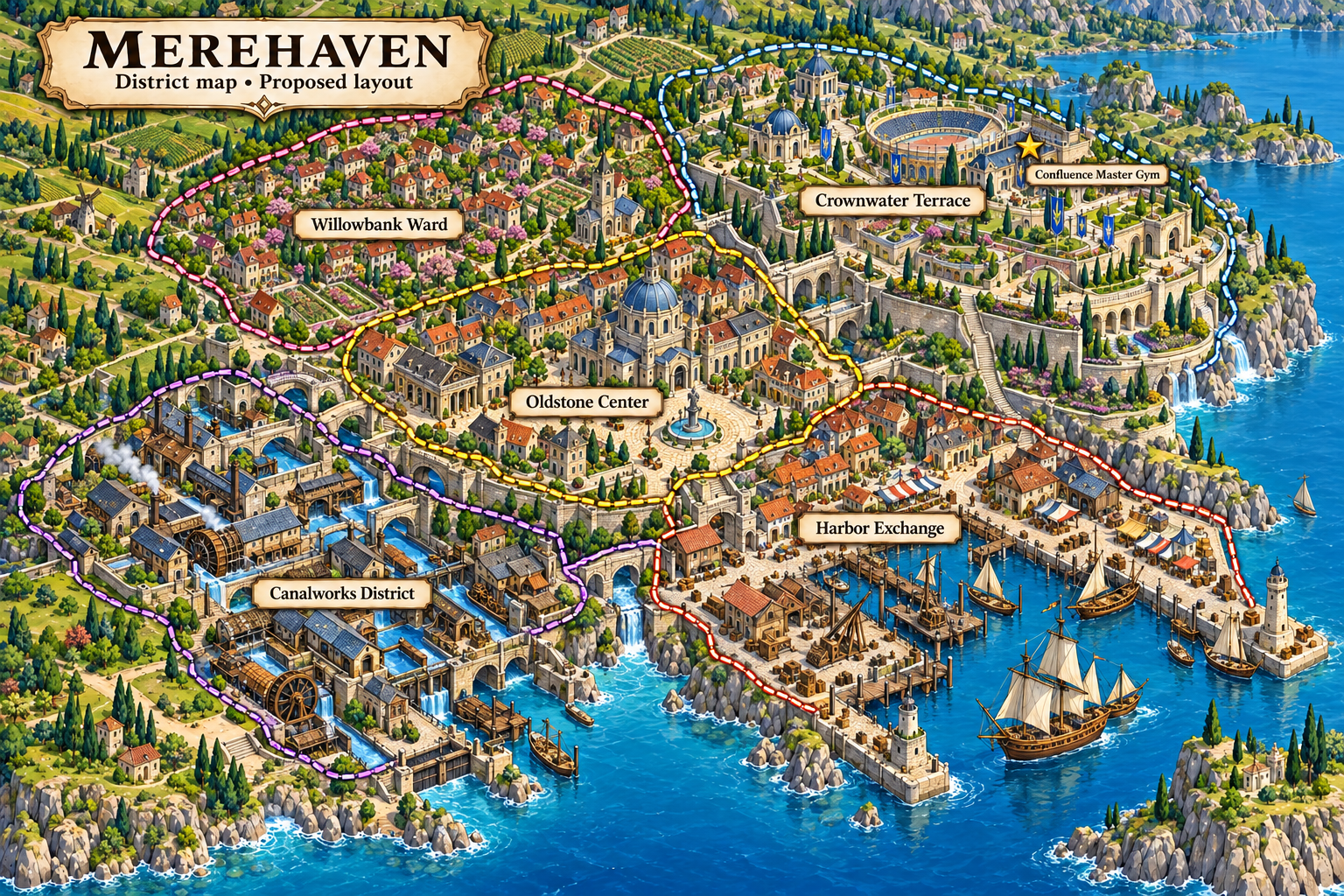
Merehaven →
Lake city on the northwestern shore of Auvora's central lake, surrounded by fertile country. Its central position makes it the meeting place for the regional League and home of the Master Gym.
Gym: Confluence Master Gym
District: Crownwater Terrace
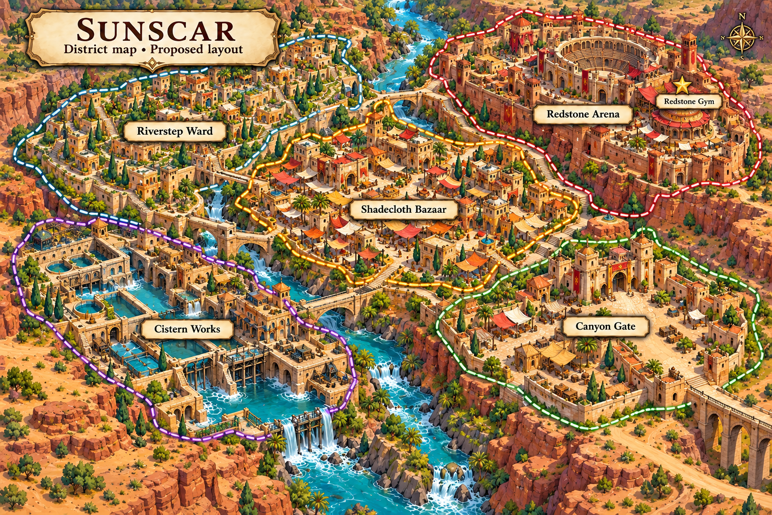
Sunscar →
Drylands city beside the river cutting through eastern hills and canyon terraces. Its five districts are shaped by shade, reliable water and travel between exposed routes.
Gym: Redstone Gym
District: Redstone Arena
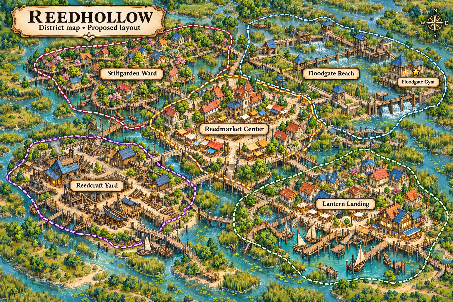
Reedhollow →
Wetland town on firm ground beside southwestern braided rivers and marshes. Its five compact districts count as the wetland settlement's urban divisions, connected by raised streets and accessible boardwalks.
Gym: Floodgate Gym
District: Floodgate Reach
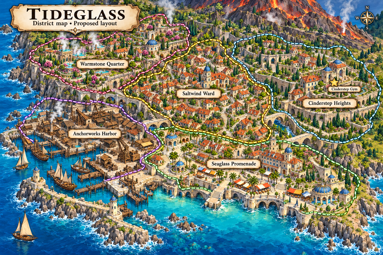
Tideglass →
Coastal city on the southwestern peninsula beneath the volcanic hill. Five districts balance a working harbor, seaside neighborhoods and the geothermal character of the coast.
Gym: Cinderstep Gym
District: Cinderstep Heights